A newly discovered kofun (ancient Japanese burial mound) on a forested hillslope in the Kamigiri of Nagaoka City via topographical surveying using an uncrewed aerial vehicle (UAV)
June 05, 2026
Key points
- A mounded terrain that was hidden by forest vegetation was newly discovered through topographic surveying using a UAV1.
- The high-resolution topographic data collected via ground-based laser scanning showed the mound has a total length of 38 m with a shape classified as either a square-front square-rear burial mound2 or keyhole-shaped3.
- Trench investigations confirmed the presence of archaeological artifacts (fragments of Haji ware4), as well as traces of anthropogenic disturbance in the subsurface structures and the inclusion of allochthonous materials, confirming that the mound was an archaeological site (kofun) and designating it as “Tsubakizawa-kofun”.
- These findings provide insights into regional society and land use in the Kofun period.
An interdisciplinary research group co-led by Dr. Takanori Mori (Associate Professor) and Dr. Ryoga Ohta (Assistant Professor) of the Faculty of Humanities at Niigata University discovered a kofun on a forested hillslope in the Kamigiri area of Nagaoka City, Niigata Prefecture. Following the detection of a mound of unknown origin on a forested hillslope through topographic surveying using UAV in 2024, the research group performed ground truth and archaeological excavation at the site in 2025. A trench investigation revealed that the subsurface profiles of mound are characterized by traces of anthropogenic digging in the uppermost saprolite of fine sandstone and intercalation of gravels in the mobile regolith, with pronounced deposition in the periphery of the rear section. The gravel deposit was mantled by sediments that contained a charcoal fragment dated to 129–238 cal CE (95.4%). The source of the gravel can be identified as the nearby lowland and/or fluvial terrace surfaces, implying that the construction of the Tsubakizawa-kofun required that sediment be obtained from the surrounding areas because the sediment supply from the ridge alone was insufficient. The present study demonstrates the importance of integrating perspectives for understanding the provenance and future of archaeological sites through examining geoarchaeological archives.
[Term explanations]
1. topographical surveying using an uncrewed aerial vehicle (UAV)
Here, “topographical surveying using an uncrewed aerial vehicle (UAV)” means using a drone equipped with a LiDAR (Light Detection and Ranging) sensor to measure the landform. LiDAR is a remote‑sensing technology that measures distance by emitting rapid laser pulses and calculating the time it takes for the reflected light to return. By combining the laser returns with precise position determined by Global Navigation Satellite System and inertial measurement data, the system produces a dense, three‑dimensional point cloud that captures the detailed geometry of terrain and structures. This survey can collect high‑resolution topographical data, even in areas that are obscured by vegetation.
2. square-front square-rear burial mound
That is a type of Kofun-period tumulus that consists of two joined rectangular platforms, one forming the rear mound and the other forming the front extension. Unlike the keyhole type, both sections are angular, giving the mound a double‑rectangular or stepped appearance in plan view.
3. keyhole-shaped burial mound
The type of kofun is characterized by a distinctive combination of a circular rear mound and a trapezoidal or rectangular front extension, forming a shape that resembles a keyhole when viewed from above.
4. Haji ware
That means a plain, unglazed, reddish‑brown earthenware produced in Japan from the Kofun period through the Nara and Heian periods (mid-3rd–12th c. CE). Haji ware is crucial for archaeological dating.
Publication Details
The findings from the first archaeological investigation of Tsubakizawa kofun and related studies were reported briefly in “Tsubakizawa-kofun 1 (Annual report of field investigation on archaeological sites in the Shimazaki River Basin VI)”, which was published on March 30, 2026. This report can be referenced on the website of Nara National Research Institute for Cultural Properties, “Comprehensive Database of Archaeological Site Reports in Japan.” This report highlights the portion of that publication.
Title:Tsubakizawa-kofun 1 (Annual report of field investigation on archaeological sites in the Shimazaki River Basin VI)
Editing Organization:Annual report of field investigation on archaeological sites in the Shimazaki River Basin VI
Editors:Takanori Mori, Ryoga Ohta
URL:https://sitereports.nabunken.go.jp/146638
More News
-

Can Organic Molecules Survive a Supernova Explosion?— First Detection of Hot Cores in a Supernova Remnant —
Research results
-
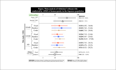
Thirty Years Later: A Reappraisal of Alzheimer's Disease Risk in Japanese APOE-e4 Homozygotes
Research results
-

Newly discovered role of amyloid precursor protein (APP) in nuclear waste disposal
Research results
-
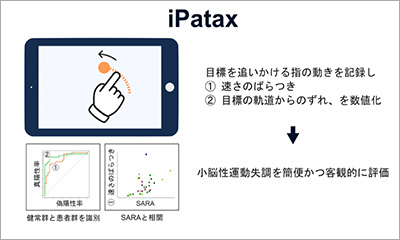
iPatax: a Tablet-based Tool for Quantitative Assessment of Cerebellar Ataxia
Research results